 |
|||||||||
|
|
CoastRanger MS An educational tool for sustainable shoreline management This project was carried out by Discovery Software and Halcrow. The project was funded from the Innovation Fund, which forms part of the Government’s Making Space for Water program. Making Space for Water is a cross-Government strategy, launched in 2005, which takes a long-term and sustainable approach to flood and coastal erosion risk management. Its aim is to manage risks through a range of approaches, which reflect national and local priorities, and which combine a reduction in the threat to people and their property with the delivery of the greatest environmental, social and economic benefit. CoastRanger MS has been designed to explain the consequences that different management approaches have on coastal processes, natural environments and flood and coastal erosion risk. The software highlights the range of interests that need to be balanced on the coast and demonstrates the difficult decisions that have to be made in some areas. CoastRanger MS simulates typical real world scenarios and provides information on management approaches, defence types, coastal behaviour and legislation. The software is intended to appeal to a wide range of audiences including:
Click on the image to view a quick start tutorial CoastRanger MS can be used in a number of ways and example tutorials take between 30 minutes and 2 hours. After this time users should have an understanding of:
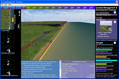
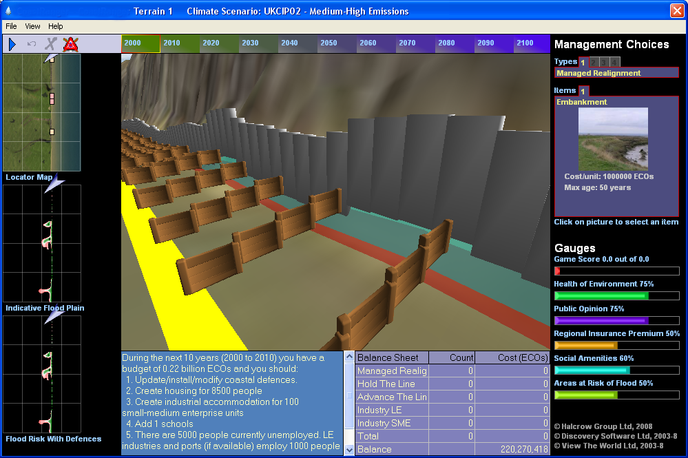
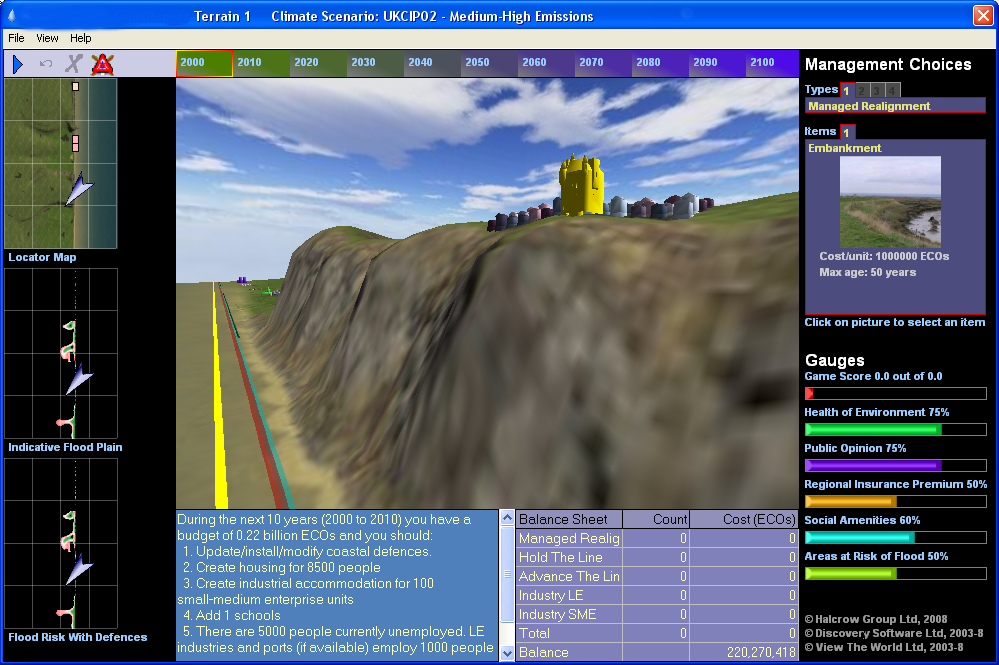
CoastRanger MS presents a virtual coastline within a pc-gaming type environment. CoastRanger MS incorporates a legacy of past developments and defences, and uses a coastal process simulator to predict the impacts of climate change under different management scenarios chosen by the user. Users are able to make various decisions about the management of the virtual shoreline and then see the consequences on screen. The stretch of virtual coast has the following characteristics:
The virtual coastline is split into 16 management units each with different combinations of morphological features. Coast Ranger MS will test your strategic skills. You will have to anticipate the effects of climate change, and balance the needs of people and the environment by building defences, houses, businesses and infrastructure. There are a number of heritage sites situated along the coast and several environmentally designated areas including dunes, terrestrial cliff habitats and wetland areas. You have a budget to control within CoastRanger MS which you can spend on defences, housing, industries and other social amenities. You can view reports on how well you have done over each Epoch and whether or not you have allowed people to become homeless or unemployed, or their properties to be flooded or eroded. Within CoastRanger MS you are required to:
The Tutorial sections explain how users undertake these actions within CoastRanger MS.
Further details: Kevin Morris: kpm@discoverysoftware.co.uk Nigel Pontee: ponteeni@halcrow.com Inovation Fund: http://www.defra.gov.uk/environment/flooding/risk/innovation/index.htm |